Century Regalia Map

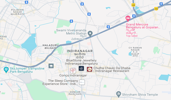
A map of a housing property shows its exact location where it is developing. The map helps buyers and visitors reach the site conveniently. It also shows the nearby areas like bus stops, metro stations, schools, and hospitals. This gives complete information about the township's surroundings.
Century Regalia map gives the exact location where the grand site is constructed. The location map of the site is Domlur, Indiranagar, Bangalore, 560038. The location of the site is one of the most expensive areas and is also highly demanded. It is close to IT hubs and also offers smooth connectivity.
Highlights of Century Regalia
| TYPE | APARTMENTS |
| PROJECT STAGE | PRE - LAUNCH |
| LOCATION | INDIRANAGAR, BANGALORE |
| BUILDER | CENTURY BUILDERS |
| FLOOR PLANS | 3 & 4 BHK |
| TOTAL LAND AREA | On request |
| Towers and block | 4 ACRES |
| RERA ID | APPLIED |
| LAUNCH DATE | PRE-LAUNCH |
| POSSESSION DATE | 2028 |
| PRICE | 6 CR ONWARDS |
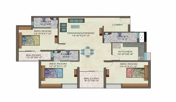
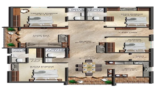
Century Regalia is a classic residential apartment project developing on 4 acres brought by Century Builders. It offers 300 stylish 3 & 4 BHK apartments with a size range of 2200 sq. ft. - 3000 sq. ft. The cost of the premium units starts at Rs 6 Cr onwards. The site has over 40 world-class amenities designed for all age groups. The site has over 80% open space and has eco-friendly features. It is waiting for the RERA approval.
Century Regalia's location map is strategically located in the prime area of the city. It shows its connectivity, civic amenities, and many more. Here is a detailed info of the location map:
- Nearby IT hubs - The Township’s location map shows the nearby IT parks and companies that save traveling time. Some of them are:
- RMZ Infinity
- RMZ Millenia
- Bagmane Tech Park
- Connectivity - Indiranagar offers sound road, rail, and air connectivity to the people. There are local cabs and BMTC buses available to reach any part of the city. The connectivity on the map shows:
- Road Connectivity - The locality connects with MG Road and Brigade Road. It also connects with Whitefield and Vivekananda Rd. There are many buses available in the area to give easy access to the city.
- Rail connectivity - The Namma Metro Purple Line passes through Indira Nagar and has 2 stations in the neighborhood. The nearest metro station is only 270 m away.
- Air Connectivity - The Bangalore Airport is only 37.5 Km away from the site. It can be reached via NH-44 and takes approx 55 minutes to reach.
- Social Amenities - The locale has top schools, colleges, and hospitals. There are banks, petrol pumps, and markets close to the township. It is also close to top malls and hotels for shopping and outings.
- Weekend Spots - The project is close to many weekend spots like lakes, parks, and malls. The Cubbon Park is only 6.7 Km away from the township, and the HAL Museum is 6.1 Km away. There are many more places for residents to go out on weekends.
The project is in the pre-launch stage and will be launched soon. The Century Regalia map is designed to give the location of the site and help the buyers reach it easily. The office of the project is also on the site. Buyers can learn more about it from the office.
| Enquiry |


